New Drilling Near Mount Ararat Renews the Search for Noah’s Ark
The story of Noah’s Ark stands among the Bible’s most legendary accounts, a narrative that has traveled across centuries through scripture, art, teaching, and popular memory. In that account a vessel is built at divine instruction, a family and living creatures are gathered, waters cover the earth, and the vessel comes to rest after the flood. For decades a strange formation in eastern Turkey has raised an extraordinary question about that story: Could this landform be connected to the remains of Noah’s Ark? Researchers are now drilling into the mysterious site in a new effort to learn what lies beneath the surface.
The Durupınar formation lies in eastern Turkey, near Mount Ararat. The mountain itself has long been associated in tradition with the landing place described in the biblical narrative. The formation’s outline looks remarkably like a boat when seen from above. It was first spotted from the air in 1959. From that moment the site has been linked to Noah’s Ark theories. Visitors, photographers, amateur investigators, and later scientific teams have returned to the same slope again and again, drawn by the boat-like contour set into the hillside.
Archaeologists and geologists from Sivas Cumhuriyet University and Noah’s Ark Scans are leading the latest research. Turkish authorities have approved the project. The work uses modern tools such as ground-penetrating radar, electrical scans, LiDAR, and core drilling. Each method is meant to map what cannot be seen from the surface alone. Ground-penetrating radar sends signals into the ground and records the returning echoes. Electrical scans measure how current moves through different materials. LiDAR records the shape of the land with high precision. Core drilling brings physical samples up from depth so that laboratories can examine them directly.
Now, for the first time in decades, researchers are drilling directly into the formation. The team says it has taken core samples from depths of up to around 18 meters. The work proceeds hole by hole. Crews set the rig, lower the bit, recover the core, label the sample, and move to the next position. The recovered columns of earth and rock are logged, photographed, and prepared for laboratory study.
According to the researchers, some of the samples contain material rich in organic matter. The drilling has also found cavities filled with mud and water. Organic-rich layers invite closer chemical and microscopic study. Cavities filled with mud and water show that the interior of the formation is not a single solid mass. Those spaces will be mapped against the earlier remote-sensing results so that the team can see how the physical samples match the patterns already recorded underground.
Earlier scans reportedly found unusual features underground, including straight lines, right angles, and long empty spaces. Some researchers believe they could resemble corridors or chambers. Straight lines and right angles stand out in a landscape otherwise shaped by slope, erosion, and volcanic debris. Long empty spaces appear in the radar and electrical records as zones where the signal behaves differently from the surrounding material. The current drilling program is designed to test those records by reaching the depths where the anomalies were noted.
The site’s size has also fueled speculation. It is about 157 meters (515 feet) long. Supporters of the Noah’s Ark theory say that length is very similar to the measurements given in the Bible. In the biblical account the vessel is described in cubits. Converted into modern units, those figures fall close to the length measured on the Durupınar formation. That numerical correspondence is one of the reasons the site has remained in public discussion since the aerial photographs of 1959.
New excavations surrounding the formation continue as the cores come out of the ground. Andrew Jones, founder of Noah’s Ark Scans, spoke last week, as reported by Newsweek. “We have not identified any material as ancient wood or established its age,” he said, “no laboratory results are in yet.” He described a specific moment in the field: “In one hole inside the formation, at about 4–5 meters, the drill bit broke on a hard layer. We do not yet know what it was. Petrified or heavily mineralized wood is one possibility we want tested; a hard rock block within the surrounding debris is another.”
He added, “When I said in our release that these layers could be the decayed top-tier remains of the Ark, I was describing the hypothesis we are testing, not a finding.” The distinction matters for the way the project is presented. The team is collecting material, sending it for analysis, and waiting for laboratory dates and identifications. Until those results arrive, the work remains a test of a hypothesis rather than a completed identification.
Scans carried out months ago revealed tunnels and other unusual features that some researchers say appear to line up with the dimensions of Noah’s Ark described in ancient texts. Some supporters have claimed the site has been confirmed as Noah’s Ark. The scans themselves show linear voids and geometric alignments. Those images are now being compared with the cores taken from the same depths. Alignment with the ancient measurements is part of the case made by people who favor the ark interpretation.
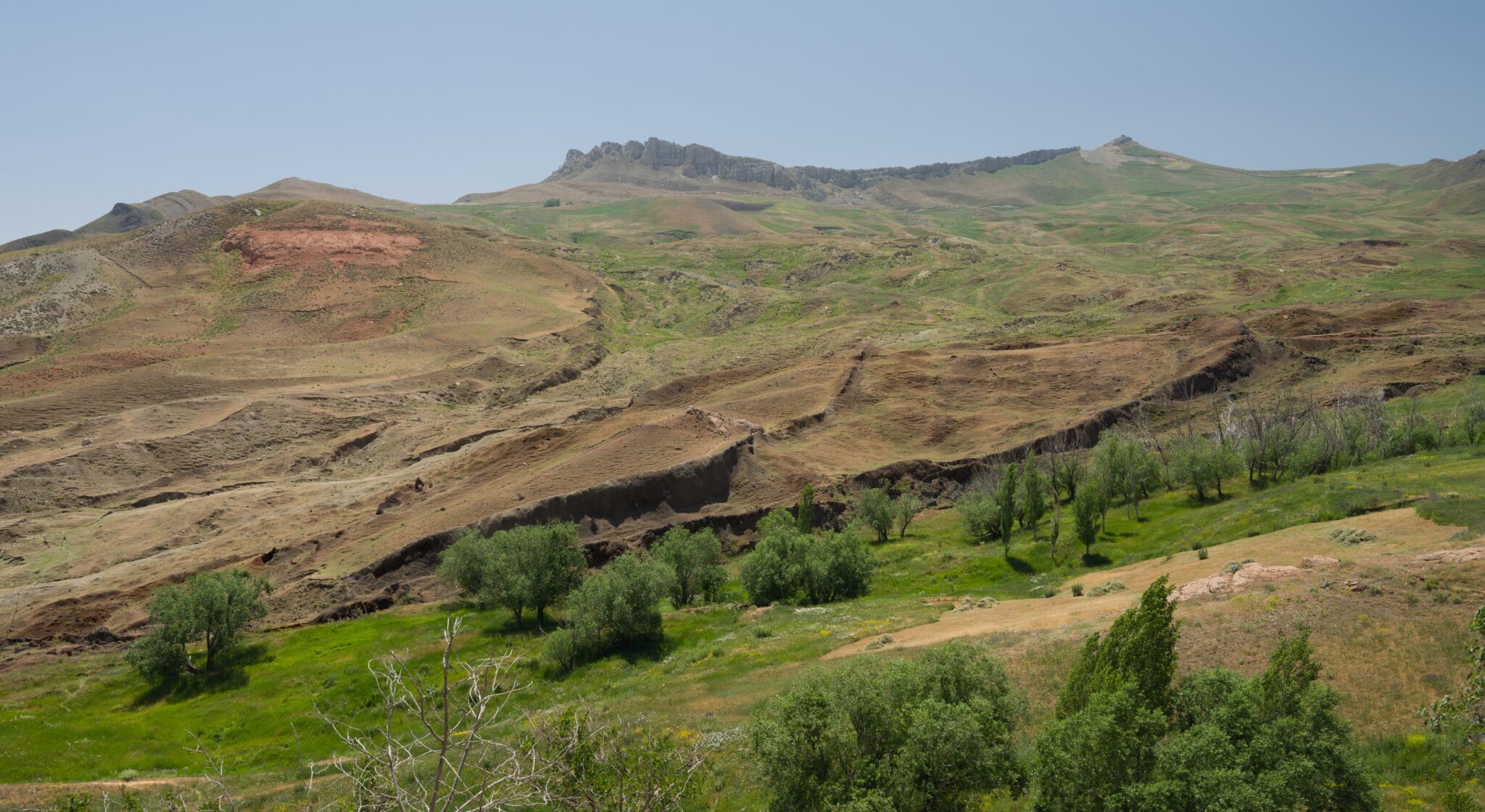
Geologists have long said that the Durupınar formation is a natural feature made of limestone and volcanic material. The belief among many earth scientists is that natural processes shaped it over many years. Limestone, volcanic debris, mudflows, and erosion can produce elongated, boat-like outlines on a hillside. That geological reading has been part of the discussion since the formation became widely known. The present campaign does not erase that reading. It adds new physical samples to the same conversation.
The latest drilling and laboratory tests may provide more clues. They have not proved that the site is Noah’s Ark. Andrew Jones noted that the team is studying the material recovered from the ground in greater detail, with more findings expected in 2027. Dating methods, mineralogy, and organic-chemistry tests will take time. The schedule reaching into 2027 reflects the pace of laboratory work and the need to repeat measurements on multiple cores.
After more than 60 years of speculation, the mystery remains. Researchers hope the material being brought to the surface will help explain what this strange, boat-shaped formation really is. The formation still sits on the slope near Mount Ararat. The cores still travel from the drill site to the laboratory. The radar maps, the electrical profiles, the LiDAR surface model, and the physical samples now form a single archive that future papers can use.
The biblical story continues to be read in churches, schools, and homes. The Durupınar formation continues to be photographed from the air and walked on the ground. The names attached to the present work remain Sivas Cumhuriyet University, Noah’s Ark Scans, and Andrew Jones. The actions remain the same: permission from Turkish authorities, remote sensing, core drilling to about 18 meters, recovery of organic-rich material, discovery of mud- and water-filled cavities, documentation of a hard layer that broke a drill bit at 4–5 meters, and laboratory study still underway.
The length of 157 meters continues to be compared with the biblical cubit measurements. The underground straight lines, right angles, and long empty spaces continue to be discussed as possible corridors or chambers. The hypothesis that some layers could represent decayed upper remains of a wooden vessel continues to be tested rather than announced as a finished result. The geological description of limestone and volcanic material continues to be part of the published record.
Each new core adds a column of evidence that did not exist when the formation was first seen from an airplane in 1959. Each laboratory report expected in the coming years will add dates and compositions that the early visitors could not obtain. The site itself has not moved. The question that has followed it for decades has not disappeared. The work now under way is an attempt to bring that question into contact with physical samples taken from inside the formation.
People who visit the slope see the same elongated mound that appeared in the 1959 photographs. People who read the biblical text see the same dimensions that supporters place beside the 157-meter measurement. People who study the geology of eastern Turkey see limestone, volcanic deposits, and the slow work of water and gravity. The present project places all of those views next to cores that reach 18 meters down.
Andrew Jones has been careful in his wording. The team has not identified ancient wood. The team has not established an age. The broken drill bit at 4–5 meters struck something hard. That something may be mineralized wood. It may be a block of rock inside debris. Those two possibilities will be examined in the laboratory. The statement about decayed top-tier remains was offered as the hypothesis under test.
Newsweek carried the remarks last week. The remarks keep the public record aligned with the actual state of the work: samples in hand, identifications still pending, dates still pending, more results expected in 2027. The surrounding excavations continue while the cores are processed. The radar and electrical maps from months earlier remain the guide for where the next holes should go.
The cavities filled with mud and water show that the interior contains spaces. The organic-rich intervals show that not every layer is barren mineral. Together they give the laboratories something specific to analyze. The straight lines and right angles recorded by earlier scans give the drillers targets. The biblical length gives the discussion a number that can be placed beside the tape measure on the hillside.
Mount Ararat remains the mountain named in the traditional association. Eastern Turkey remains the region. The Durupınar formation remains the landform. Sivas Cumhuriyet University and Noah’s Ark Scans remain the groups named as leaders of the current campaign. Turkish authorities remain the body that approved the drilling. Ground-penetrating radar, electrical scans, LiDAR, and core drilling remain the tools in use.
The story of the ark in the Bible remains the story of a vessel, a flood, a landing, and a family that steps onto dry ground. The story of the formation in Turkey remains the story of an aerial discovery in 1959, decades of visits, remote-sensing surveys, and now physical cores lifted from as deep as 18 meters. Those two stories occupy the same public conversation. The present research is the latest chapter in that conversation.
More than sixty years have passed since the first photographs. The outline on the hillside is still there. The question is still asked. The samples are now in laboratories. The next set of published findings is expected in 2027. Until then the formation keeps its shape, the cores keep their labels, and the work of identification continues.
Do you think this is the real Noah’s Ark? Please share your thoughts in the comments section.